Meet the hurricane hunters, whose harrowing flights are all in a day's work
"Buckle up, bumpy skies ahead."
While that warning could be announced on your next flight, it's virtually an iron-clad guarantee for the crews aboard the fleet of "hurricane hunter" airplanes and jets, whose sole mission is to fly directly into and around some of the world's most powerful storms.
The 2017 Atlantic hurricane season officially begins next week (June 1), and the hurricane hunters will again be on call this year to fly into these meteorological monsters.
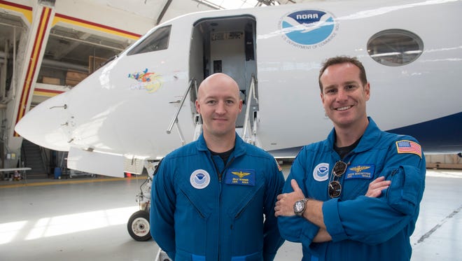
Both the U.S. Air Force and the National Oceanic and Atmospheric Administration (NOAA) operate the aircraft that fly into the storms. The planes recently were on display at Washington's Reagan National Airport as part of NOAA's spring hurricane awareness tour that visited several East Coast cities.
"We fly right through the eyewall into the heart of the storm at 5,000 to 10,000 feet above the Earth's surface," said Air Force Lt. Col. Brian Schroeder, who has flown more than 100 missions, including 50 eyewall penetrations. The eyewall is a doughnut-like ring of thunderstorms that surrounds the calm eye.
The Air Force Reserve flies 10 WC-130 turboprop planes, which are based at Keesler Air Force Base in Biloxi, Miss., and are known as the 53rd Weather Reconnaissance Squadron. These planes are the workhorses of the hurricane hunters.
An average weather reconnaissance mission lasts 11 hours and covers almost 3,500 miles, the Air Force said, and the flight typically carries from six to 15 people, both the flight crew and the weather crew. In addition to full-fledged hurricanes, the planes often fly into nascent storms, known as tropical waves or tropical depressions.
The primary purpose of these missions, Schroeder said, is to locate where the storm center is and what its maximum winds are. That key information is then sent back to the National Hurricane Center. Often, he said, whether a storm gets a name is based directly on information from the hurricane hunters.

A tropical depression becomes a named tropical storm when its sustained winds reach 39 mph.
"What makes flying through the eyewall exhilarating and at times somewhat scary are the turbulent updrafts and downdrafts that one hits," NOAA research scientist Chris Landsea said. "Those flying in the plane definitely feel these wind currents (and sometimes makes us reach for the air-sickness bags)," he said.
The crews also evaluate the storm's size and structure and send that data back to the hurricane center. Most of this data, which are critical to the hurricane's threat, cannot be obtained from satellites, according to Schroeder.
The weather data, including temperature, dew point, wind speed, barometric pressure and relative humidity, are gathered by "dropsondes," small, disposable cylindrical instruments that are dropped out of the planes and float by parachute down to the surface.
"Those data go into the computer forecast models and help us make a more accurate track forecast," said Rick Knabb, the former director of the National Hurricane Center.
The data from the hurricane hunters can increase the accuracy of forecasts by up to 30%, NOAA said, which is important in helping to narrow down the "cone of uncertainty" in storm-tracking computer model forecasts.
No civilians — other than journalists and scientists — are permitted on the hurricane hunter flights.

Above the storm
NOAA operates two separate missions into hurricanes: The Gulfstream-IV jet, which flies above and around hurricanes, and two WP-3D Orion turboprop aircraft, which fly into hurricanes mainly for research purposes.
The jet is used for both hurricane forecasts and for research purposes, hurricane center spokesman Dennis Feltgen said. There is one Gulfstream jet and, this year, just one Orion turboprop (the other Orion is being re-winged), he said. The NOAA flights are out of MacDill Air Force Base in Tampa.
The Gulfstream jet is the nation's "only high-altitude hurricane reconnaissance aircraft," pilot Lt. Dave Cowen said. He said it usually does not penetrate the hurricane eye but instead flies above the storm at heights of 41,000 to 45,000 feet, deploying anywhere from 20 to 40 dropsondes along the way.
The jet often flies over hundreds of miles of ocean around a storm, measuring the winds that are steering it; information which helps forecasters better predict where a storm is heading.
The Gulfstream also flies research missions into the very tops of hurricanes, away from the worst turbulence and rain.
NOAA's Orion turboprops collect data from inside storms for research purposes. On those flights, onboard scientists direct the aircraft to those parts of the storm of interest, which might not be near the eye of the hurricane. Experiments might be planned to examine the outer rain bands or the hurricane's interaction with the environment.
Information from these flights is also shared via satellite with land-based forecasters to keep them current on the storm's status.

Research scientists from colleges, universities and other organizations sometimes join the flights.
History of the hunters
Army Air Force Colonel Joseph Duckworth piloted the first plane that intentionally flew into a hurricane near Houston, on July 27, 1943. He made two flights that day, calling them "experimental instrument flights," according to the book Hurricane Watch.
With World War II raging, the military knew that tracking and flying into Atlantic hurricanes and Pacific typhoons were vital, which "motivated leaders to make airborne hurricane reconnaissance a standard weapon in the forecaster's arsenal," the book said.
Hurricane fliers had their first success the next year with what came to be called "The Great Atlantic Hurricane of 1944." (Storm names didn't begin until 1950.) Navy and Army Air Forces airplanes tracked the storm from when it was north of Puerto Rico until it slammed into the eastern end of Long Island and New England after sideswiping North Carolina.
The hurricane killed 50 people in the U.S., but newspapers and magazines as well as officials credited the warnings the flights made possible with keeping the death toll much below the 600 of a similar 1938 hurricane, which hit Long Island and New England without warning.
Since the first flights into hurricanes and western Pacific typhoons (as hurricanes are known there), three Air Force airplanes have gone down in typhoons (in 1952, 1958 and 1974), and one Navy plane in an Atlantic hurricane (in 1952). All 36 crewmembers and passengers aboard the four airplanes were lost.
The Navy stopped flying into hurricanes in the 1970s. Airplanes no longer fly into western Pacific typhoons.

